Case Study: LiDAR Forest Inventory, Almaty
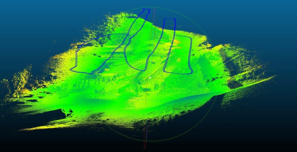
LiDAR: One instrument to rule them all, or still a work in progress?
Case Study: Reality Capture VR Tour of Tamgaly UNESCO Heritage Site
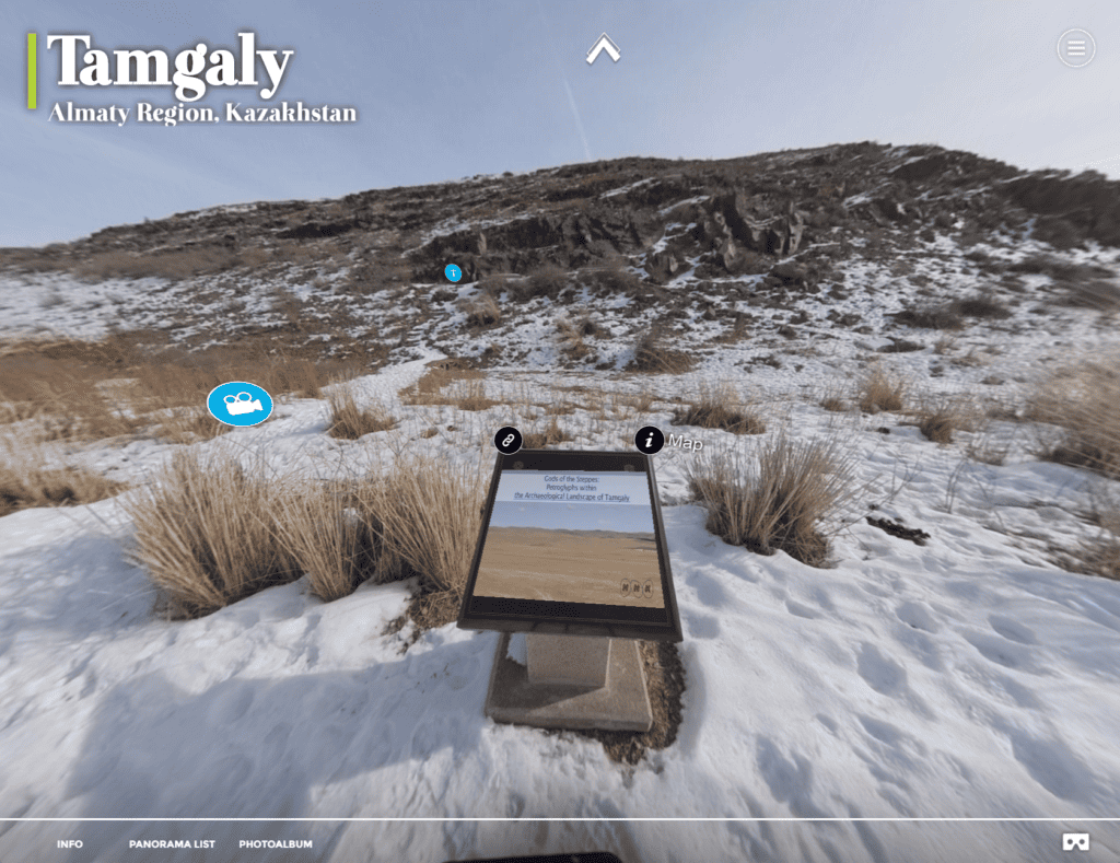
Explore the Tamgaly UNESCO World Heritage Site in Kazakhstan and see how rTek makes Reality Capture Interactive Virtual Tours.
Case Study: Almaty Tree Digital Twins
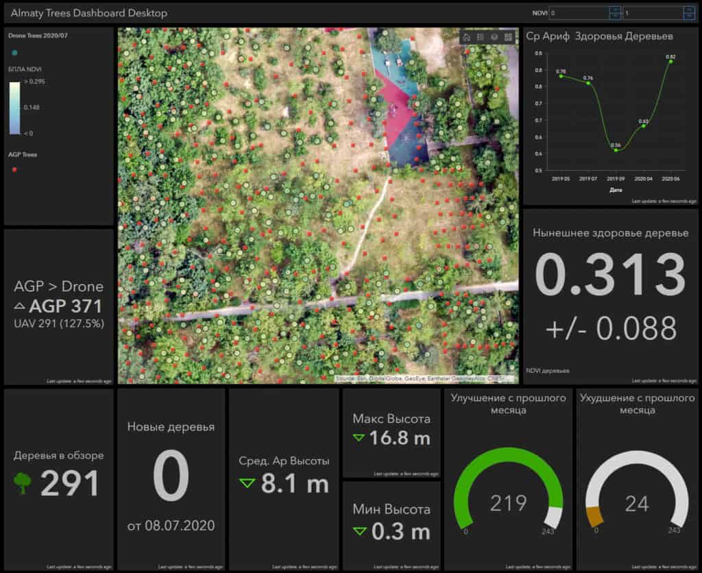
We set out with consumer UAV equipment to count a grove of 10,000 trees, model their height and health. In this case study, we explore the limits of UAV image-based digital twins in afforestation and reforestation applications.
Why Precise Point Positioning is Critical for the Highest Quality Datasets
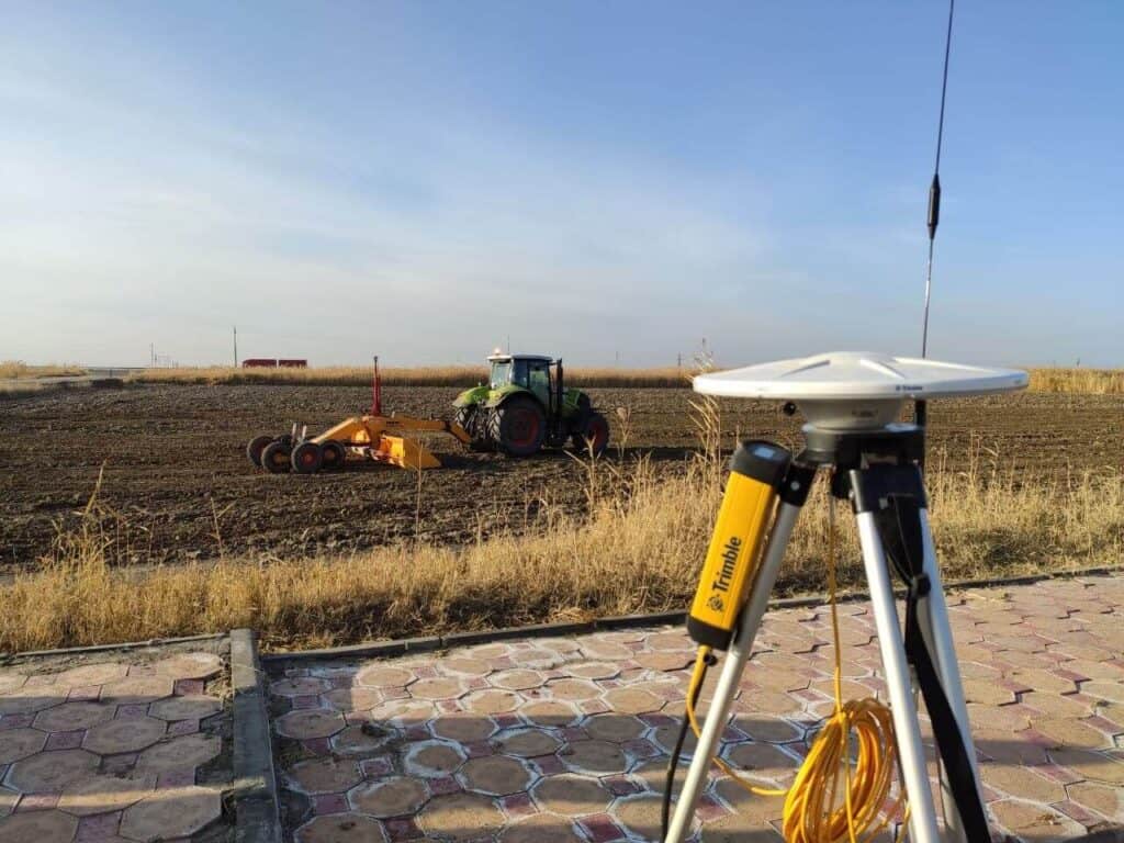
Let’s demystify PPP, RTK, PPK, and CORS- the main technologies enabling centimeter-level accuracy when using satellite based positioning systems.