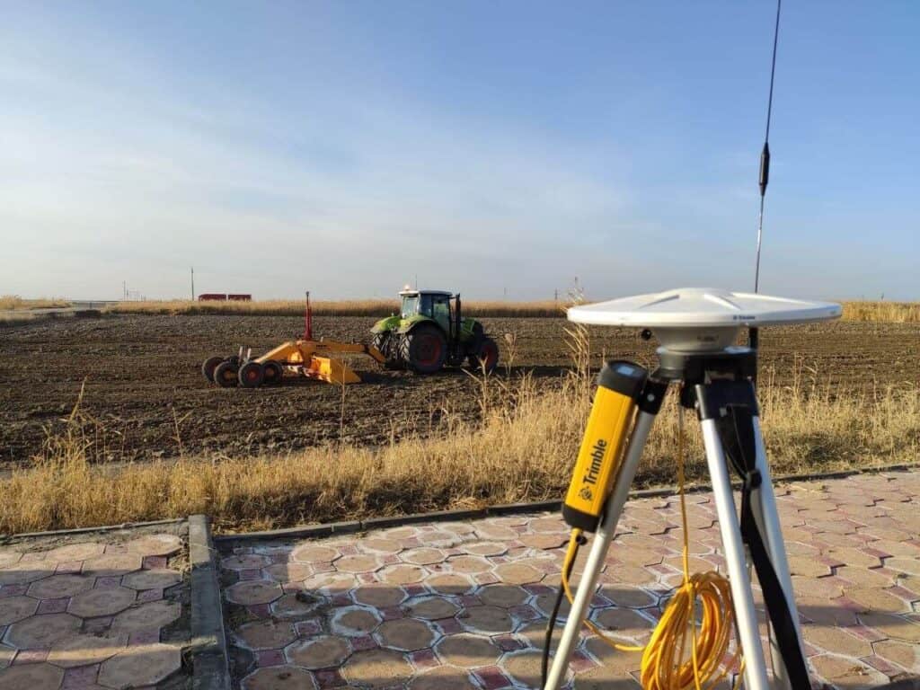
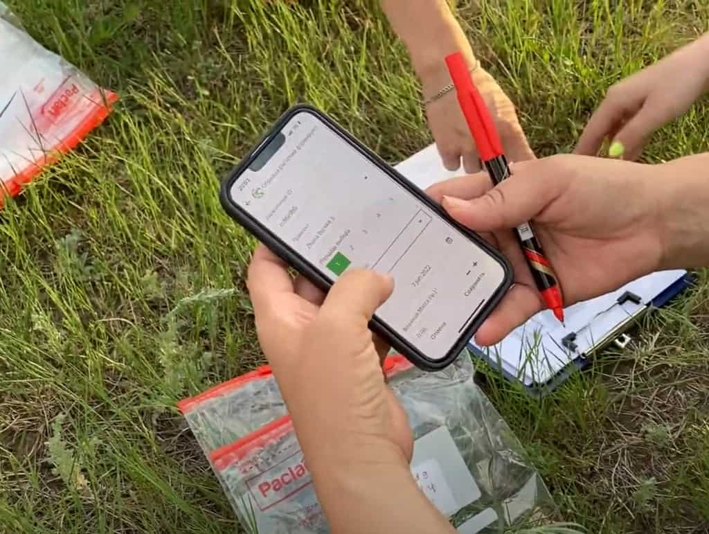
What is Soil Sampling: A Basic Guide for Soil Organic Carbon
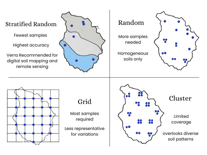
In the vast steppes of Kazakhstan, where agriculture meets the challenge of climate change, understanding the soil beneath our feet is more crucial than ever. Soil sampling methodologies aren’t just technical jargon—they’re the foundation for sustainable farming, carbon sequestration projects, and environmental conservation. At rTek, we’re pioneering advanced soil sampling techniques tailored to Kazakhstan’s unique […]
The State of Soil Carbon Sequestration in Kazakhstan
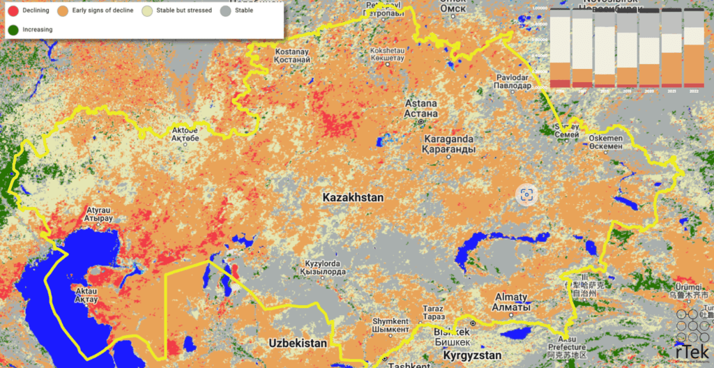
Carbon Sequestration has immense potential in Kazakstan, but more research is needed to reduce risk for project developers.
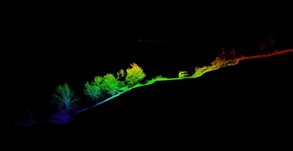
Case Study: LiDAR Forest Inventory, Almaty
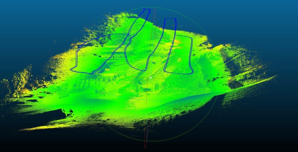
LiDAR: One instrument to rule them all, or still a work in progress?
Case Study: Reality Capture VR Tour of Tamgaly UNESCO Heritage Site
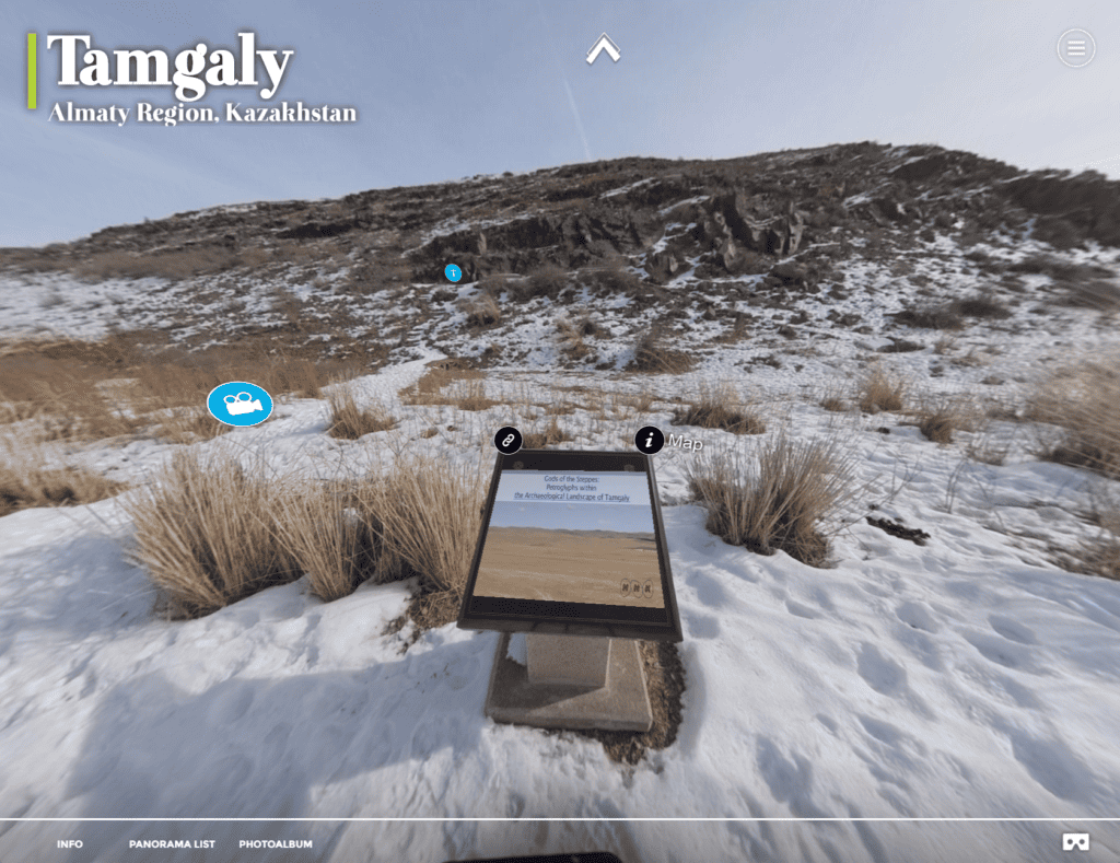
Explore the Tamgaly UNESCO World Heritage Site in Kazakhstan and see how rTek makes Reality Capture Interactive Virtual Tours.
Case Study: Almaty Tree Digital Twins
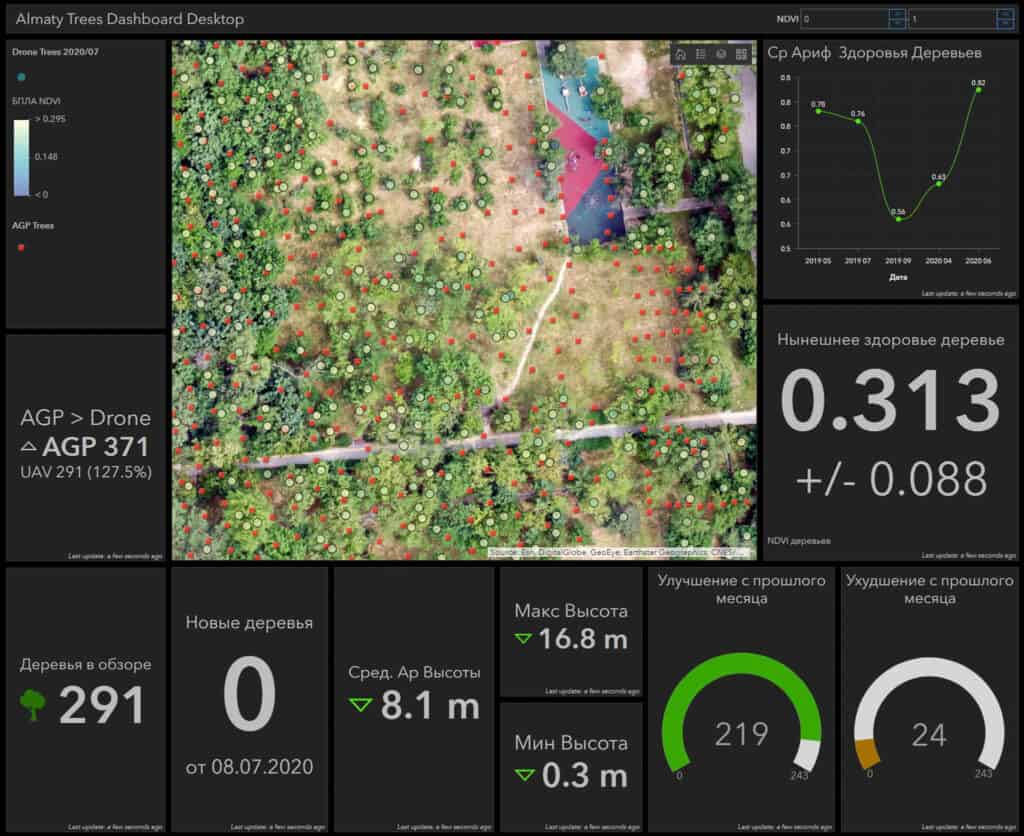
We set out with consumer UAV equipment to count a grove of 10,000 trees, model their height and health. In this case study, we explore the limits of UAV image-based digital twins in afforestation and reforestation applications.
Why Precise Point Positioning is Critical for the Highest Quality Datasets
Let’s demystify PPP, RTK, PPK, and CORS- the main technologies enabling centimeter-level accuracy when using satellite based positioning systems.
DEM vs. DTM vs. DSM – What’s the difference?
Why so many acronyms? Do you really need to know what they all mean? Yes, if only to know the one word to replace them all.
Top 5 GIS Use Cases for 2023
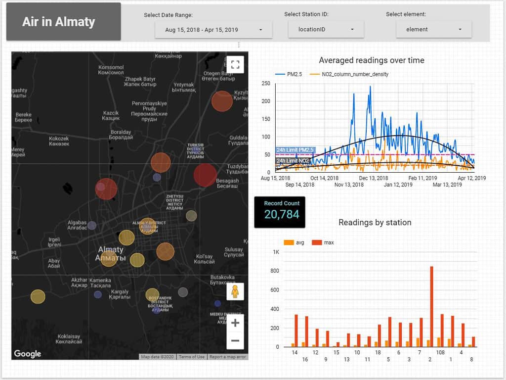
GIS is incredibly useful. Here are the top use cases in 2023.
Rangeland Inventory: Unveiling the Future of Sustainable Ranching
Discover how rTek’s innovative rangeland inventory tools and technologies empower farmers and ranchers to optimize stocking rates, identify invasive species, and manage soil erosion for sustainable and productive rangeland management in Kazakhstan.